Skårvågsfjellet is a 403-metre mountain in the municipality of Bø on Langøya in Vesterålen. A route description on the Norwegian hiking portal ut.no counts it among the finest and easiest mountains to walk in Bø. We climbed it on 1 October 2026, our second hike that day after Bufjellet above Sandvika. From the summit you look over countless small islands to the pointed Gaukværøya and the mountains of Lofoten behind it. You go up and down on the same path, 4.6 km in total according to ut.no.
Parking and the start
We park on the road to Skårvågen, at the turn-off just past the bay of Krumsvågen. This spot is recommended in the route description on ut.no. According to it, you turn right at the roundabout in Straume and follow the signs to Skårvågen and Søberg. After about 2 km keep right towards Skårvågen, and after another 500 m there is a house on the right. You can walk up from the house or drive another 100 m round the knoll to an old side road where parking is easy. The path starts there almost at sea level.
The climb
At first the path is very muddy. It crosses a bog on a few wooden boardwalks, up behind Rambergfjellet according to ut.no. Then comes the steepest part, about 100 metres of ascent according to the route description. After that the path continues over the ridge and old peat bogs until you see the sea on the other side. At a fork, left leads to the summit and right to Tverrfjellet. The last stretch is stony. The route description calls it a moonscape and advises keeping right along the edge there. According to ut.no, the rock formation Dørhollet lies 50 m before the summit.
Even on the way up we have very beautiful views. After about 400 metres of ascent and an hour and a half we stand on the summit. It is warm and there is no wind, and we walked up in T-shirts, in early October in northern Norway.
On top and back down
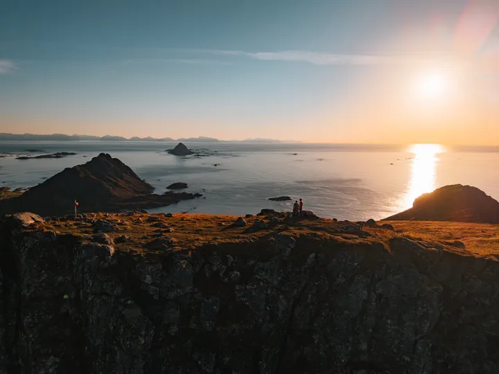
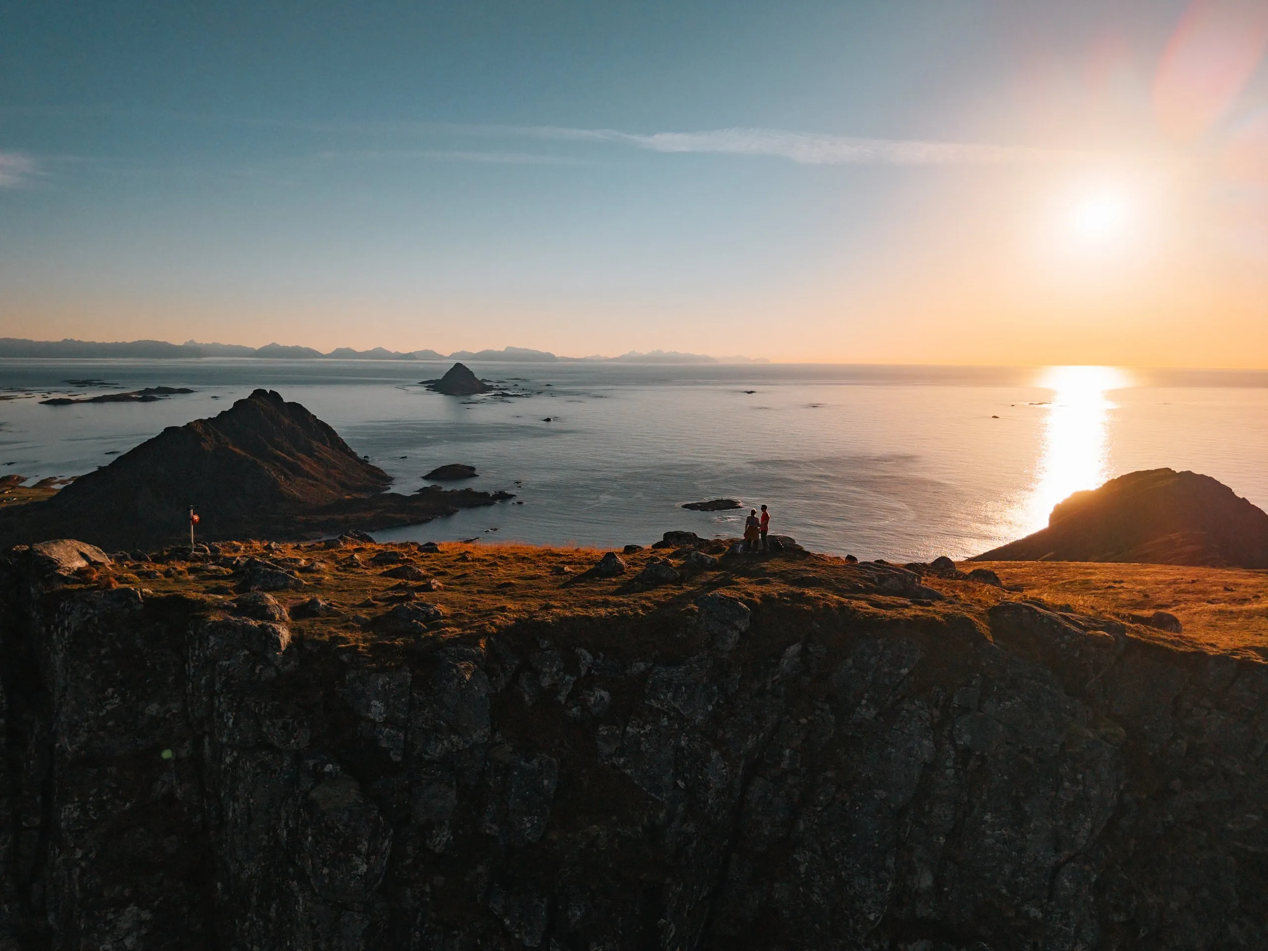
The summit sign reads «Skårvågsfjellet 403 moh.», and below it hangs a red box with the code T124. With this code or by GPS you register your visit in the «Stikk UT!» app. We are completely alone up here. Because it is so calm, Nicolas sends up the drone and takes a few photos and videos of us on the summit. The sun is already low and draws a bright band across the sea.
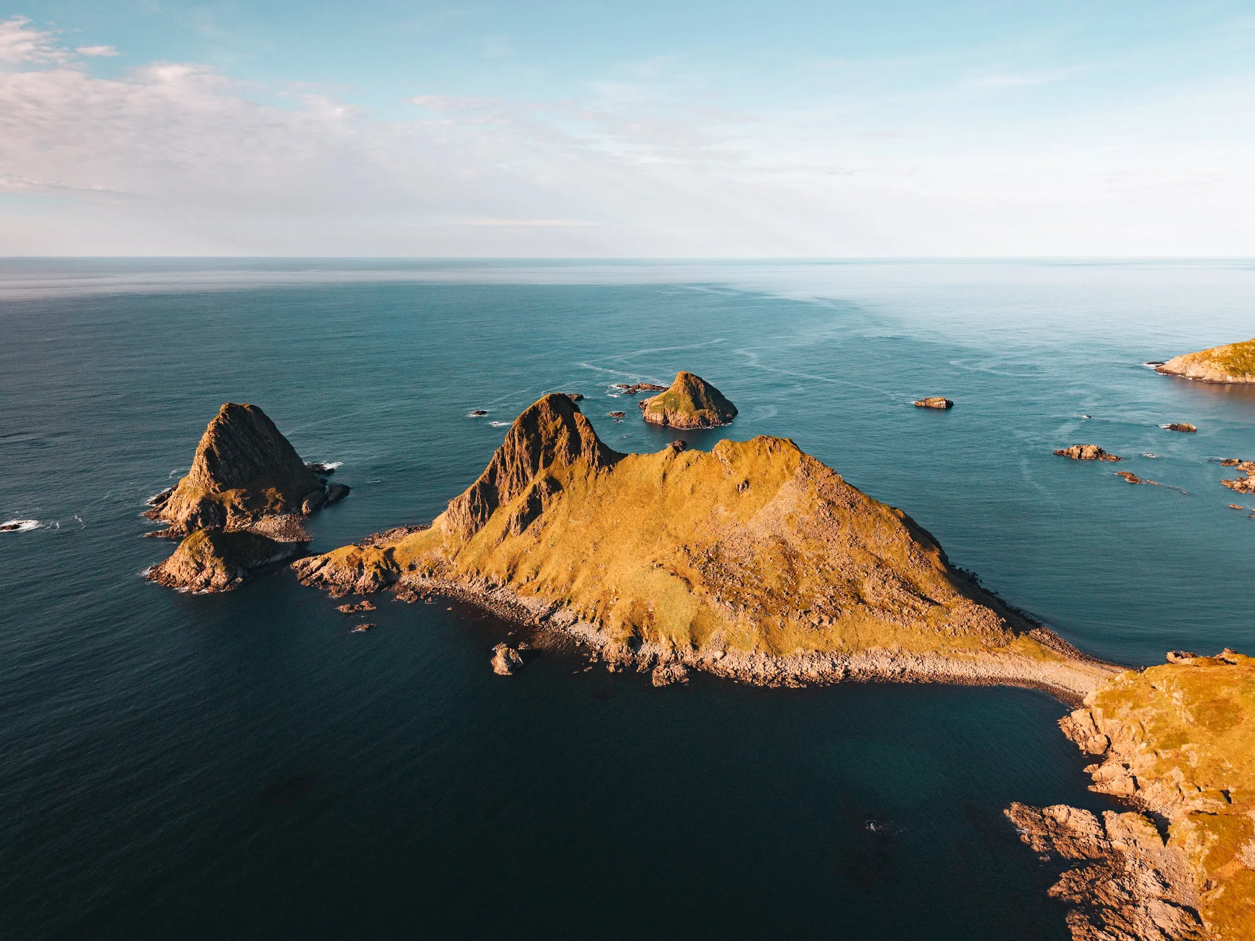
From up here there is an all-round view of islands, mountains and fjords, and you can see a long way. Below us lie countless small islands, one of them shaped like a heart. Just over nine kilometres to the south-southwest lies the pointed island of Gaukværøya, and behind it the mountains of Lofoten line up on the horizon. Nobody lives on Gaukværøya today. Around 1910 about 130 people lived there, making their living from fishing. When the fishermen got bigger motorboats, the island lacked a proper harbour, and there was neither a road nor electricity. On Langøya the houses by then had electricity, running water and telephones, and from 1946 more and more families moved there. The state supported the move of the families from Gaukværøya and the neighbouring island of Litløya with 125,000 kroner. In 1953 the last three families took down their houses and moved them to Langøya. Today only foundation walls and stone quays remain on the island.
Down is the same way. We walk down in the light of the setting sun. Ahead of us lies the pointed Gullstabben, the highest point of the peninsula near Søberg, and below it the bay of Krumsvågen. We get back down to the car just as the sun disappears into the sea at 18:26. We did not record how long the descent took. The route description on ut.no allows two and a half hours for the round trip.