The Old Man of Stoer is a sea stack off the Stoer peninsula in Assynt, in the north-west of the Scottish Highlands. According to Wikipedia it is 60 metres high and made of Torridonian sandstone, Walkhighlands gives 70 metres. From the car park at Stoer Head Lighthouse a path leads north over the cliffs to it.
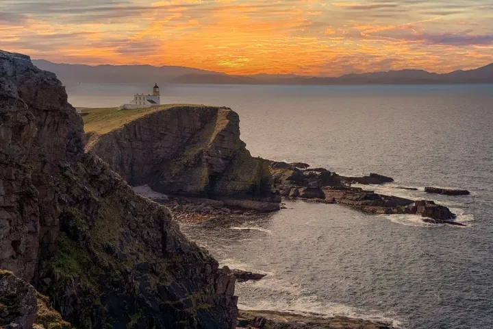
We were there on 6 April 2023, on our road trip through Scotland. The road to the lighthouse is very narrow and winding, and at one point, reversing, we have a lorry in front of us and a sheep behind us. It is a challenge, but well worth it for the views. We do not quite make it to the Old Man of Stoer because the path is too muddy, but we have a great view of the lighthouse. We did not record where we parked, how far we got or how long we were out. The map, the numbers and the GPX therefore show the whole path to just short of the Old Man and back the same way, not our shorter stretch.
Parking at the lighthouse
According to Wikipedia the lighthouse stands at the end of a 5 km road that branches off the B869 between Lochinver and Unapool. According to Travel Made Me Do It you turn off the B869 at the Assynt Crofters’ Trust towards Balchladich and then follow the signs to the lighthouse. Just below the lighthouse there is a free car park, according to Masarnen Ramblers two areas side by side with room for about 16 cars. According to Britain Express there is sometimes a coffee van there. According to Walkhighlands there is no public transport.
According to Wikipedia David and Thomas Stevenson built the lighthouse in 1870. The tower is only 14 metres high, but from its high cliff it can be seen 39 km out at sea. It has been automated since 1978.
According to Masarnen Ramblers the path starts between the two car parks, to the left of a track. According to Walkhighlands this track climbs off to the right, but for the Old Man you take the grassy path with the signpost that gives 3 km.
Along the cliffs to the north
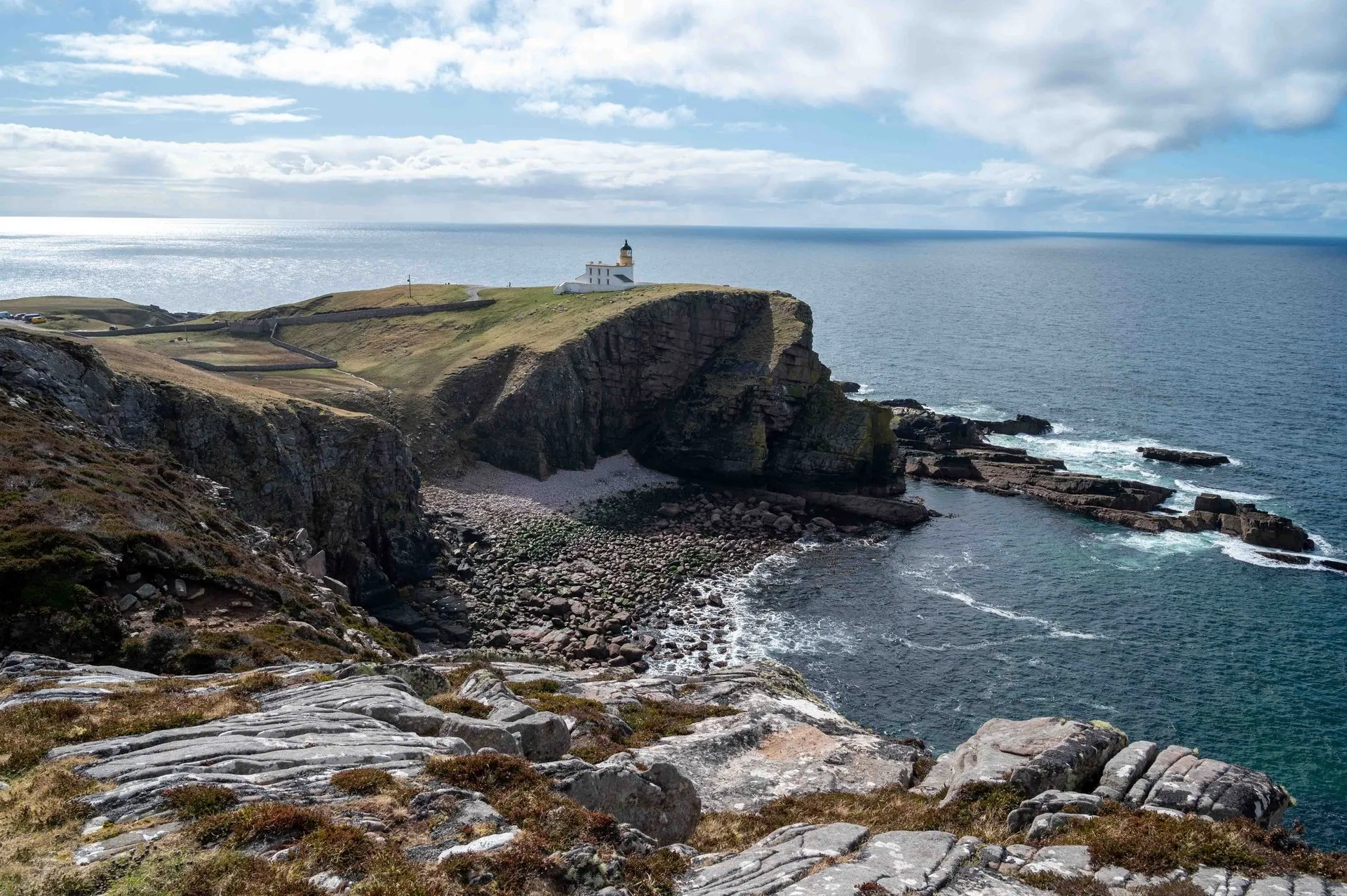
According to Walkhighlands the path is wide at first, but faint and fairly wet. It climbs parallel to the coast, and soon there are great views back to the lighthouse. Our photos show this view. Our post does not say where exactly we took them, but judging by the angle it was on the cliffs north of the lighthouse.
After that, Walkhighlands says, the ground gets drier and the path fades to a sheep track. After about a kilometre a deep grassy gully cuts across the route. You detour a little to the right until you can cross it. On our track the path makes a bend inland at km 1.0, and at the fork you keep left, back to the coast. According to Britain Express the path dips down into a small ravine at one point and up the other side, which calls for a bit of agility. According to Masarnen Ramblers the route drops into a grassy gully on a stepped path at Geodh’ nan Daoine.
According to Walkhighlands the projecting rock of Cirean Geardail comes into view on the left another kilometre further on. There the coast dog-legs to the right, and ahead lies the highest section of the cliffs with the Old Man at its far end. On our track this bend lies at km 2.0. The path then climbs and at km 2.7 reaches the highest point of the track at about 110 metres. According to OpenStreetMap a path turns off to Sìthean Mòr there. According to GeoKs several paths run roughly parallel on the way north, at varying distances from the edge, and the cliffs drop by up to 100 metres.
Down to the Old Man of Stoer
According to Walkhighlands the coast and the path then descend fairly steeply to a grassy area immediately above the Old Man. Our track ends at km 3.1 on this slope, about 140 metres south of the stack. There and back that is 6.2 km with 255 metres of ascent. The terrain model has many gaps along the cliffs, though, so the ascent and heights are only approximate. According to Britain Express the walk to the Old Man takes 30 to 45 minutes.
According to Wikipedia the Old Man was first climbed in 1966 by Brian Henderson, Paul Nunn, Tom Patey and Brian Robertson. To reach the foot of the stack, climbers need a Tyrolean traverse. According to Britain Express fulmars nest on the stack and on the cliffs nearby.
From here, according to Walkhighlands, the route continues along the coast to the Point of Stoer. You return the same way or over Sìthean Mòr. According to Walking Englishman it is 161 metres high. A path then leads to the track to the radio mast, which passes the remains of a Second World War radar station on its way down to the car park. For this circuit, which our map does not show, Walkhighlands gives 7 km, 2.5 to 3.5 hours and 360 metres of ascent.
Walkhighlands grades the circuit 3 out of 5. It calls the coast rough and wet, pathless at times, and the return over the hill probably easier. Care is needed by the cliff edges. The bog factor is also 3 out of 5: Much of the walk may be dry, but some sections can be very wet, and waterproof boots are recommended.