Skip to content
PIXELS & TRAVELS

Suggestions

PIXELS & TRAVELS
Deutsch / English
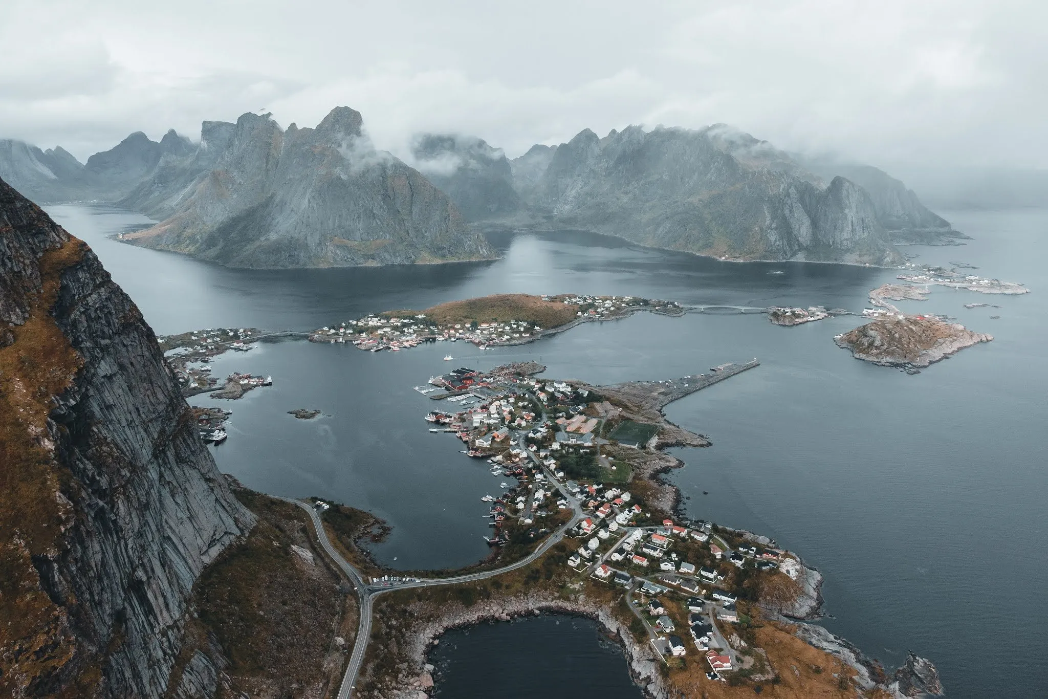
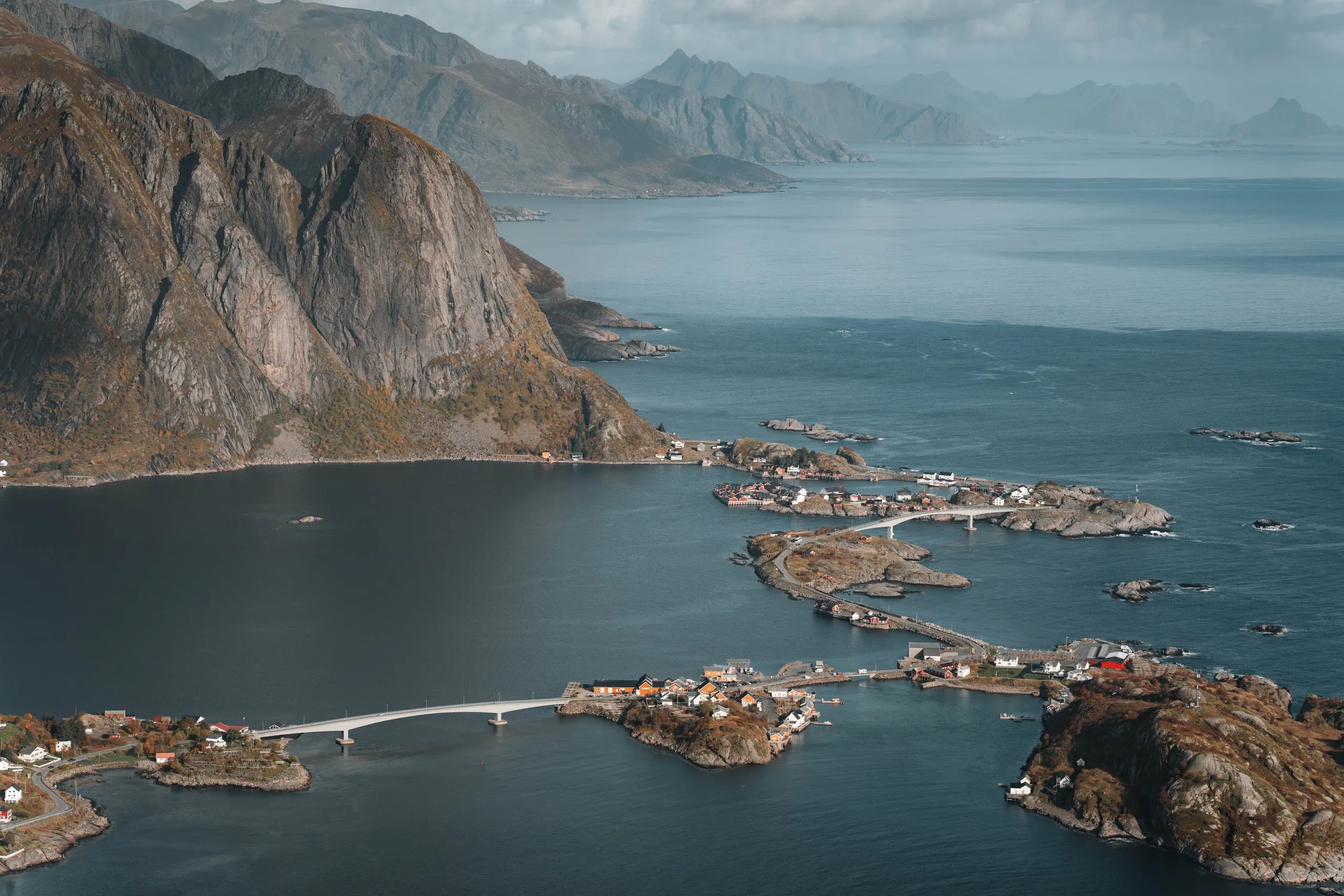
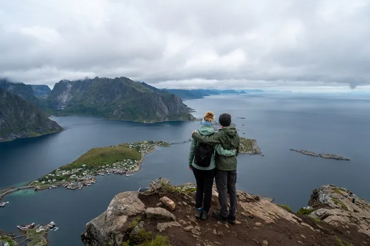
View from Reinebringen over Reine, the small islands and the bridges in the fjord, a steep rock mountain on the left
Moskenesøya, Lofoten

Reinebringen

Up the sherpa steps to Reinebringen above Reine: Free parking at Steffenakken, 430 metres of ascent in just over a kilometre, with map and GPX.

4.7 km · 455 m ascent · There and back

At a glance

Distance
4.7 km There and back the same way
Ascent
455 m Descent 455 m
Highest point
449 m Reinebringen
From the trailhead
431 m over 1.0 km, 41 % average gradient
Start and parking Steffenakken car park

Steffenakken car park on the E10 south of Reine, free. From there 1.3 km north along the road to the trailhead.

67.9119° N · 13.0744° E

Route from OpenStreetMap, heights from the national terrain model. At your own risk, check paths and conditions on site.

Difficulty

Blue, moderate

DNT scale (Norway) · Official grade ↗

Steep and almost all stairs, some of them high, technically easy

Our time
About 45 minutes up the stairs, plus 15 to 25 minutes each way along the E10
Best time
May to September. In winter the climb is strongly discouraged because of avalanches and rockfall.
Route description · 3 sections

The route

Elevation profile of the climb Drag across the profile to read it

Map and path © OpenStreetMap contributors (ODbL). Heights: Kartverket DTM 1 (CC BY 4.0).

Reinebringen is the best-known viewpoint in the Lofoten, and we have climbed it three times: In September 2021 in fog, in August 2022 with sunshine until just after the top and in September 2026 on the finest day of the week. The path is short, but it goes steeply up almost without a break. At the top Reine with its small islands and bridges lies below you, on the other side a long fjord reaches inland between the mountains.

Parking and the walk to the trailhead

Parking in Reine itself is expensive. At the visitor centre of Lofotodden National Park, EasyPark showed a little over 8 francs after 15 minutes, and the app only shows the price once you have parked. So we park at the Steffenakken car park on the E10 south of Reine. It is free and lies south of the bridge across the Djupfjord. Parking is only allowed in the marked areas, not on the side of the E10 and not in the village.

From the car park it is 1.3 km north along the road to the trailhead with the information board. It took us about 25 minutes in 2022 and about 15 minutes in 2026. The walk has one advantage: By the foot of the stairs we are already warmed up.
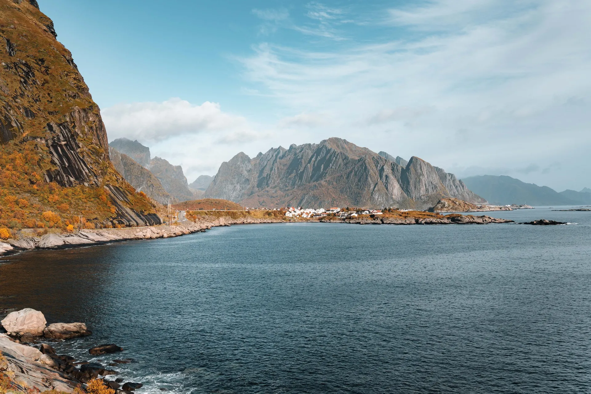
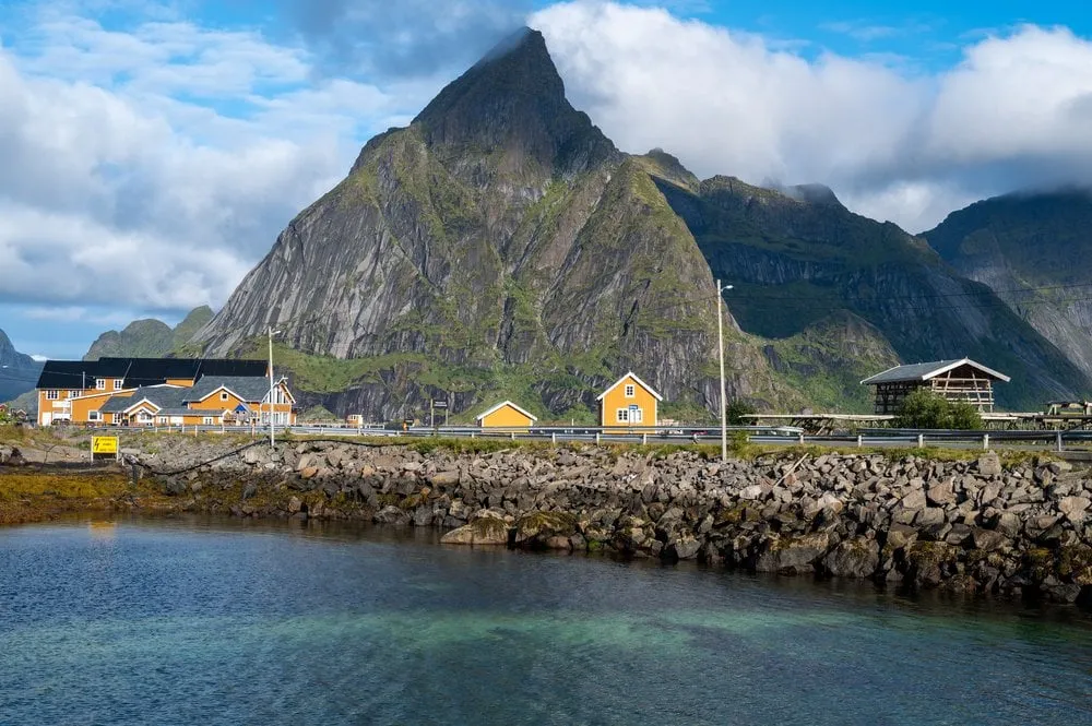
Rocky shore and blue water on the E10 near Reine, houses below jagged mountains in the distance, a steep rock face on the left

The sherpa steps

From the trailhead a stone staircase built by sherpas from Nepal climbs the whole slope. There are almost 2000 steps to the top, and signs along the way show how many lie behind you. In just over a kilometre the path climbs from the road to 449 metres, so about 430 metres of ascent. In 2026 the stairs took us about 45 minutes. Many steps are high, and on fine days the stairs and the top are busy.

In September 2021 the stairs were not finished yet. Back then there were 1566 steps, after that the path went on through deep mud and over rocks. Today the stairs reach all the way up to the ridge.

On the sherpa steps to Reinebringen · 2 photos

At the top and back down

The stairs end on the ridge above Reine. From there you see the village with the bridges between the islands, the long fjord on the other side and the road along the coast out to the open sea. In 2026 we stayed up there for a long time and took photos of each other against this backdrop. In 2022 we ate our sandwiches at the top, and the clouds came shortly after. In 2021 it was heavily overcast and foggy at the top.

The view from Reinebringen over Reine and the fjords · 4 photos

The way down follows the same stairs. The descent is easier on the lungs but harder on the legs, because every step has to be cushioned. In 2021 we washed our shoes in a mountain stream after the muddy stretches.

The season runs from May to September. In winter the climb is strongly discouraged because of avalanches and rockfall. If you want the view without the crowds, go early in the morning.
Sources

Details that do not come from our posts we looked up here:

Photo stops along the way

Photo stops

The photo spots on this route, where they are along the way and the best time.

At km 1.9 · 254 m

Reinebringen, Lofoten

A stone staircase built by Tibetan sherpas, 448 metres of ascent, then the best-known view in the Lofoten over Reine and the fjords.

Best time: Morning, before the crowds

At km 2.2 · 420 m

Reinebringen Viewpoint

The most famous view in the Lofoten, reached via the sherpa steps (about 1 hour up). Reine, fjords and peaks in a single frame.

Best time: Early morning · June to September

In the travel diary

Three visits

The days we spent out here.

  1. 2021 4 September 2021 · 3 min read View from a great height onto a headland with small houses, a road and a fjord, mountains behind it in low clouds Reinebringen - Å
  2. 2022 30 August 2022 · 2 min read The yellow houses of Sakrisøy below Olstind above clear water Sakrisøy - Reinebringen
  3. 2026 24 September 2026 · 4 min read View from Reinebringen over Reine, the small islands and the bridges in the fjord, a steep rock mountain on the left Reinebringen and Northern Lights
Print

This view as a print

On museum-quality paper, canvas, aluminium Dibond or acrylic glass, in sizes from 30 × 45 to 70 × 100 cm.

From CHF 42.-

Newsletter

Stay in the loop

New posts and photo spots straight to your inbox.

No spam. Unsubscribe anytime.