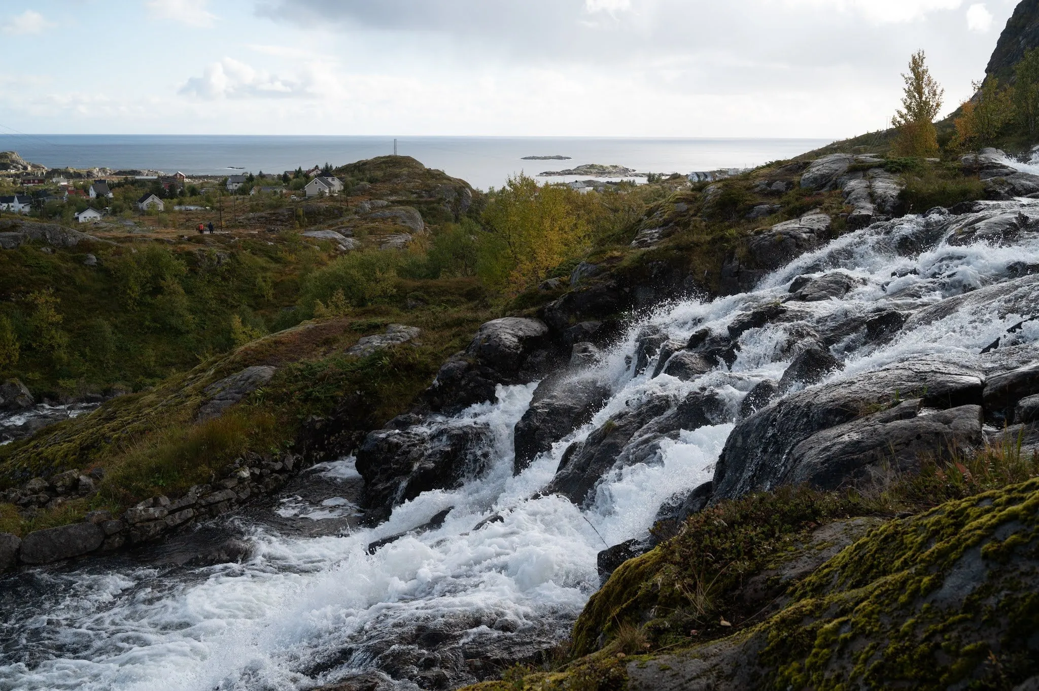
Above the fishing village of Sørvågen on Moskenesøya, the Olaelva flows down from Stuvdalsvatnet into Sørvågvatnet. Photo sites such as Locationscout and Photohound list a waterfall in Sørvågen as «Lofoten Waterfall». The site World of Waterfalls calls it Sørvågen Waterfall and writes that it has no official name. OpenStreetMap shows an unnamed waterfall on the Olaelva. The way there follows the start of the marked route to the Munkebu hut. It is a short walk, and you return the same way. According to Wikipedia, Sørvågen belongs to Moskenes Municipality and has about 400 inhabitants.
We were there on 13 September 2021. The day is rainy with plenty of hail, so we spend the morning in our accommodation and plan the next few days. In the afternoon there is a little sun, and we drive to Sakrisøy to photograph the little yellow hut once more. There we meet a Norwegian who now lives in the Netherlands and is visiting the same photo spots as we are. We get chatting, and he gives us the tip to drive to a waterfall nearby. We wait out the next hail shower in the car, then walk from the car park to the Lofoten Waterfall. For Swiss people it is more of a little waterfall, but it is lovely all the same. We walk around the area a bit and enjoy a few rays of sunshine. Afterwards we stop briefly in Reine and Hamnøy.
Our post does not describe the way. We did not record which car park we used, where we walked or for how long, nor how far we walked around the area afterwards. We conclude from the name and from our photo that we were at the Sørvågen waterfall. It shows water plunging over dark rock steps, with houses behind, a hill with a mast and the sea with two small islets. The same islets and the mast on the hill appear in a photo by World of Waterfalls that looks over the lower part of the waterfall towards the Atlantic. The map and track therefore show the way as the sources describe it. It leads from the hikers’ car park at Sørvågvatnet along the marked trail towards Munkebu to the waterfall that OpenStreetMap records on the Olaelva.
Parking and the way to the waterfall
According to ut.no, the outdoor site of the Norwegian Trekking Association DNT, there is a car park with a fee at the start on the west side of Sørvågvatnet. According to In the Woods, Dear, the toilets there also cost a little, and campervans are not allowed to stay overnight. Users of park4night give a fee of 50 kroner for the summer of 2021. Since 2025, according to their entries, there has been a ticket machine where you buy a ticket with your number plate. Four hours cost 60 kroner there. According to World of Waterfalls, the car park is rather small and fills up quickly.
From the car park, according to World of Waterfalls, you follow the signs on an obvious path from which you can already see the waterfall. After about 250 m there is a signposted junction, in our track after 0.24 km. To the right, a path leads 2.5 km round Sørvågvatnet. Towards Munkebu you climb a moderately steep granite slab beside the cascade. OpenStreetMap records this stretch as a mountain path on which the trail is barely visible. It is part of the route from Sørvågen to Munkebu. From the top, according to World of Waterfalls, you look down on the Studalselva and a waterfall in front of the peaks of Vestertinden and Støvla. Shortly afterwards, according to OpenStreetMap, the path crosses the Olaelva on a bridge. Just beyond it, a path leads a good 30 m upstream to the waterfall that OpenStreetMap records on the Olaelva. Our track ends there, after 0.56 km. There and back it is 1.1 km with 35 m of ascent. The car park lies 19 m above sea level, the highest point at 50 m. According to Locationscout, it is about a ten-minute walk from the car park in the village. Photohound rates the place as easy, with a short walk and hardly any change in elevation.
There are several waterfalls here. According to Locationscout, three fairly big ones lie close together. According to Photohound, the waterfall has several cascades, and for the main cascade you have to leave the marked trail and cross the stream. World of Waterfalls also describes a smaller cascade on the Olaelva, which flows into Sørvågvatnet further down. Our post does not say which of these waterfalls we saw, and our photo does not settle it. Our track therefore ends at the waterfall that OpenStreetMap records.
On towards Munkebu
If you carry on, according to ut.no you follow the floodlit trail up to Stuvdalsvatnet and a good, clear path along its east side towards Tridalsvatnet. Then a cairned path climbs steeply to the Kjølvatna lakes and continues over Djupfjordheia to Lofoten Turlag’s Munkebu hut. According to ut.no the route is only partly marked, with scattered T markings. The hut has six beds and must be booked, it is not open to day visitors. According to In the Woods, Dear, it is about 5 km each way from Sørvågen with about 540 m of ascent, about four to five hours there and back. The blog rates the route as demanding, with ropes and chains to help on steep sections. According to the blog, swimming in Stuvdalsvatnet is not allowed, because it supplies drinking water.