
The night at Rifugio Saoseo is fairly sleepless, and when the alarm goes off at a quarter to seven we wake up stiff. At 7 am we sit down to breakfast. There is Bircher muesli, coffee, orange juice and bread with cheese and strawberry jam. When we step outside the hut afterwards, only the topmost ridge above Lungacqua is glowing in the first sunlight, and there is frost on the meadow.
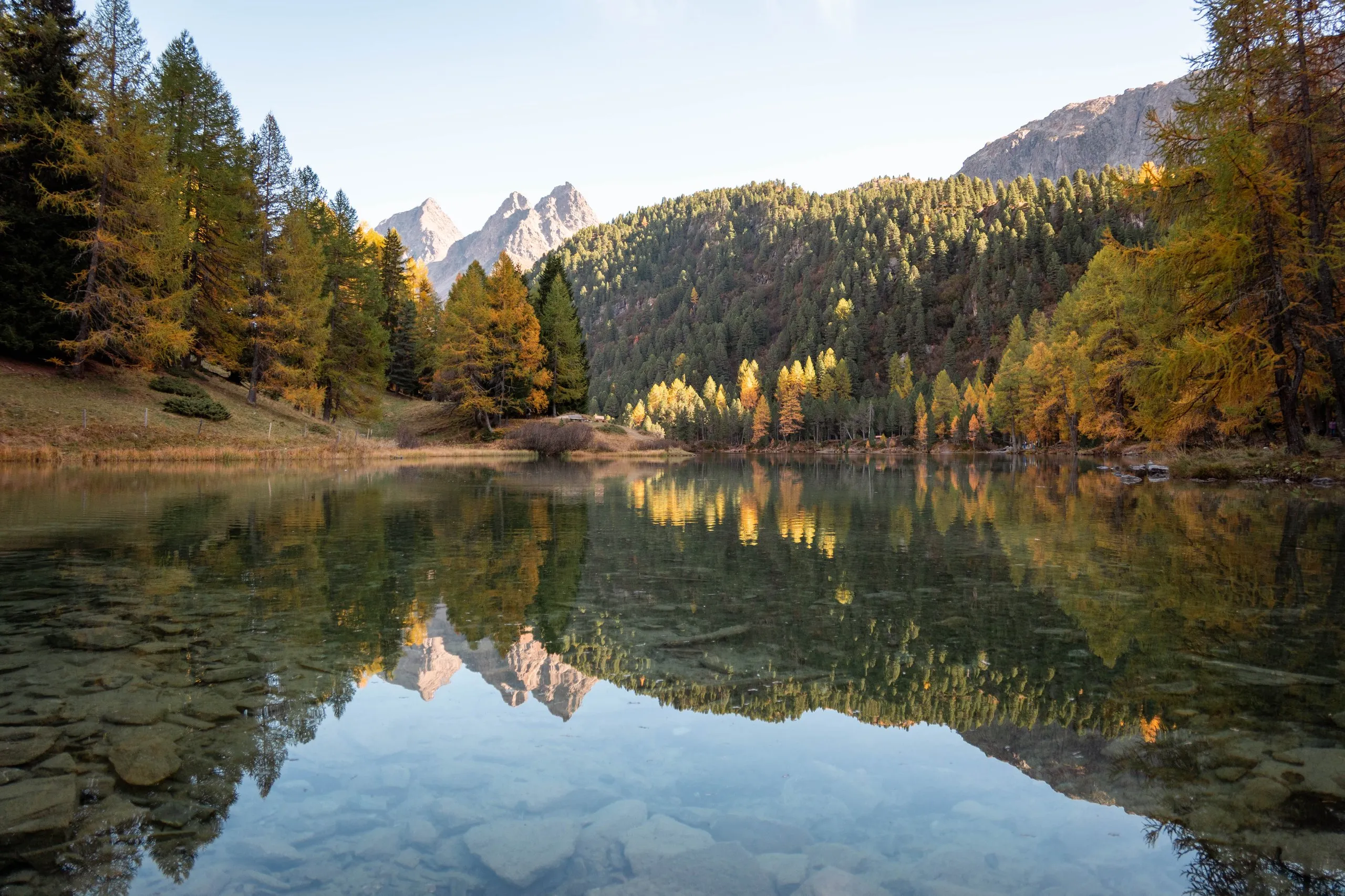
Our plan is to be at Lagh da Saoseo for the golden hour and photograph the lake in that special light. From the hut it is only about 15 minutes to the shore. When we arrive, however, the light is more like the blue hour. The lake lies in a wooded hollow, and the mountains and the forest are still hiding the sun. Only the snow-covered peaks to the west, above the forest on the far shore, are already in the sun.
Along the frozen forest path to Lagh da Val Viola
So we hike on to Lagh da Val Viola and choose the longer path, which takes us an hour and a half. The forest path is frozen, and it is probably around minus one degree. It is very beautiful and once again leads through larch forests that have turned yellow. Among the needles on the ground we spot a fly agaric.
Lagh da Val Viola lies at 2159 metres in the uppermost part of the valley, which here is itself called Val Viola. At a good nine hectares it is the largest lake in the Val da Camp, almost four times the size of Lagh da Saoseo, but less well known. A small island can be reached along a causeway. Lagh da Val Viola and Lagh da Saoseo are both dammed by the boulders of a rockslide from the end of the last ice age and by moraines. Above the lake lies the Pass da Val Viola on the border with Italy, and on the Italian side there is a second lake with almost the same name, the Lago di Val Viola.
The lake is very calm, and once again the larch forests and the mountains are reflected in the water. To the west stands the rock pyramid of the Corn da Mürasciola, with the snow-covered peaks and glaciers of the Bernina group behind it on the left. On a narrow path marked white-red-white we walk along the shore to the northern side. There, on a gravel shore, we line up with Markus and Sabrina for a photo. It is already almost 11 am and nearly lunchtime, so we have our picnic by the lake.
A swim in Lagh da Saoseo
Afterwards we head back to Lagh da Saoseo, where we go for a swim. The lake has no inflow above ground. It is fed by groundwater, which is why it is so clear. On the bottom you can see large boulders and sunken tree trunks, and for its small surface it is surprisingly deep, 17 metres at its deepest point. On the shore the four of us take another photo, and Sabrina does a headstand. By now the sun is shining on the lake, and the water glows turquoise.
Nicolas sends up the drone and takes a panorama above the lake. Today the sky is blue, and behind the lake stand the freshly snow-covered pinnacles of the Scima da Saoseo.
Back to Sfazù and home
Then we go to Alp Camp once more and again eat Bündner Nusstorte and apricot tart, with coffee, hot chocolate and iced tea.
For the way back to Sfazù we take the gravel road that runs down through the valley. The hut gives an hour and a quarter for the road up from Sfazù and two hours for the hiking trail we took the day before. The Val da Camp is about seven kilometres long and drops from the Pass da Val Viola at 2432 metres to Sfazù at 1622 metres. As a quiet, remote mountain landscape with many mountain lakes, it is listed in the Federal Inventory of Landscapes and Natural Monuments of National Importance. At Sfazù our car is waiting where we parked it yesterday.
From there it takes two and a half hours to Chur. From Chur it is another two and a half hours by train to Basel SBB, with a stop for food at Zurich main station.
Comments
Questions, tips or just a hello: We are happy about every message.