Sätragruvan is a disused mine in the forest between Skärblacka and Finspång in Östergötland, on road 215. We were there on 17 June 2021. After breakfast on the sun terrace of our accommodation near Norrköping we drive to the abandoned mines. The path to the mine entrance is short, but when we were there large fallen trees lay across it. According to Udda Utflykter, Sätragruvan used to be on the municipality of Finspång’s tourist maps and was signposted, and after collapses in the tunnels the signs were removed.
According to naturinfo.nu, the company AB Kis began mining pyrite here in 1916, in the middle of the First World War. Because sulphite could no longer be imported during the war, the pulp and paper industry needed its own, and it could be obtained from the sulphur ore. About 80 people worked in the mine, as naturinfo.nu, Folkbladet and tadigut.nu all write. According to vonklopp.se there were about a hundred employees including the processing plant, and about 80,000 t of ore were broken in total. Udda Utflykter gives 1917 to 1919 as the years of operation. After the end of the war there was no longer a market for the pyrite, according to naturinfo.nu. AB Kis went bankrupt, according to tadigut.nu, and in 1922 the property was sold. Of the processing plant, the foundations remain according to vonklopp.se, and according to tadigut.nu concrete foundations rise out of the undergrowth there. The employees’ houses have been renovated and are lived in, according to vonklopp.se.
Our posts do not record where we parked. According to tadigut.nu you park at the barrier of one of the gravel tracks that lead from road 215 to the mine. It is not an official car park, but there is plenty of room. From the barrier a dirt forest track leads east and then north. According to tadigut.nu you come out onto a clear-cut and see the mines on the right, with paths leading through the clear-cut. In OpenStreetMap the track ends there, and a path leads south to the mine. According to tadigut.nu these paths are hard to see from a distance. On our track it is 0.54 km each way, so about 1.1 km there and back on the same path, with only a few metres of climb. We did not record a walking time, and none of the sources gives one either.
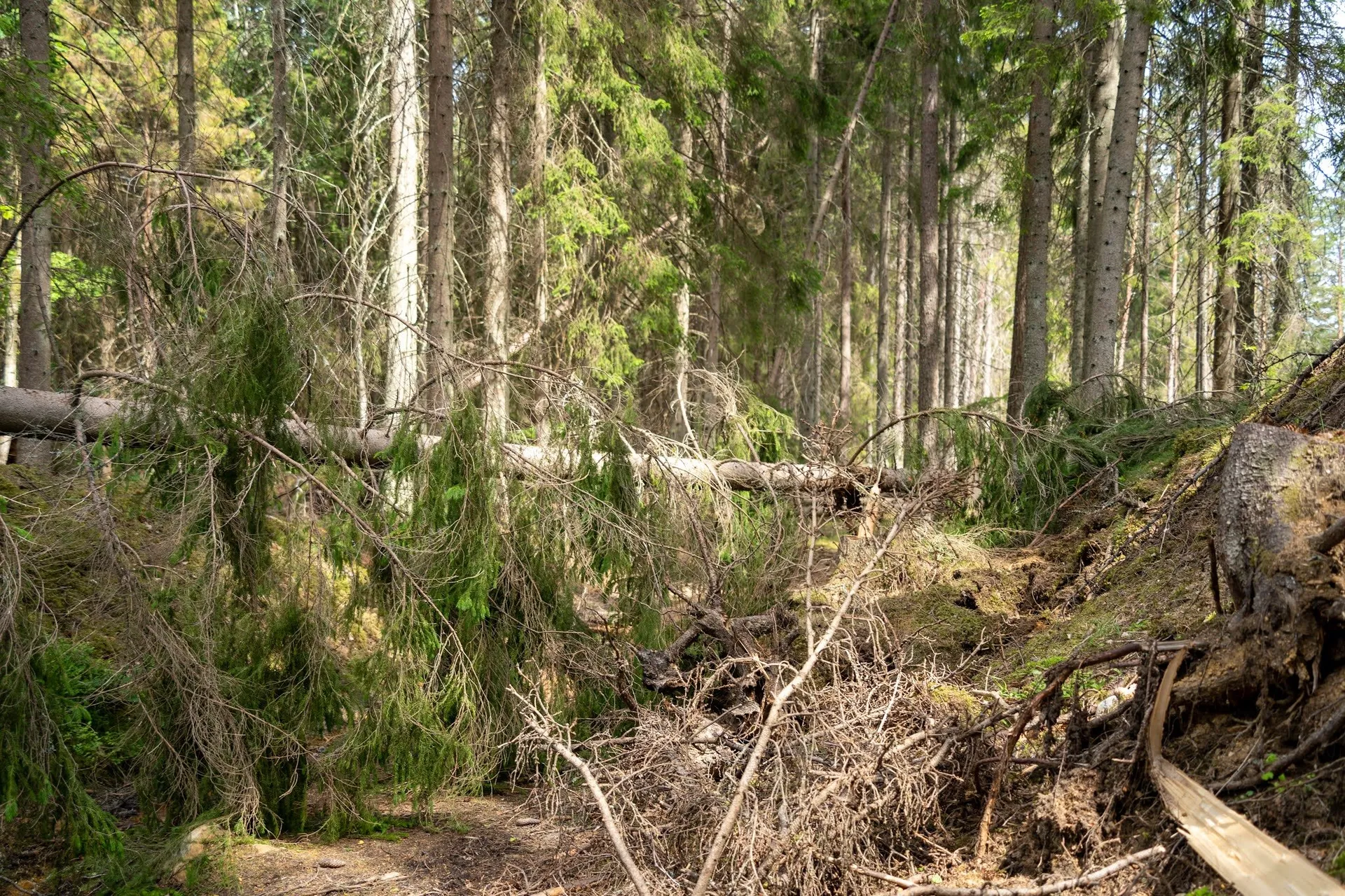
We walk through the very dense forest, which is characterised by old spruces, moss and hanging lichen. The path is partly blocked by large fallen trees, and we have to find a passable path ourselves. tadigut.nu also mentions fallen trees. It is a very hot day, in the afternoon the temperature climbs well above 30 degrees.
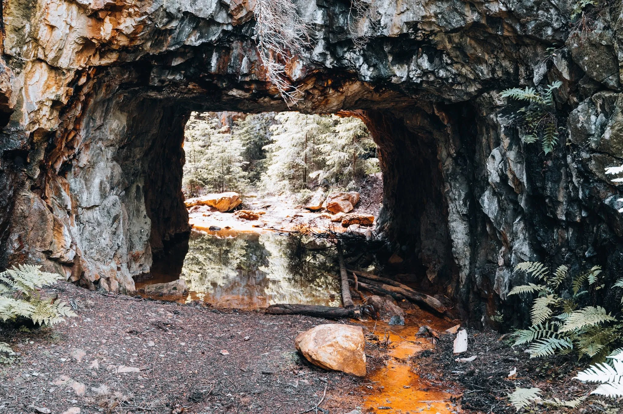
At some point we spot a fenced-in area ahead of us, in which we can walk up to the entrance of the former mine. Beyond that you cannot continue without rubber boots, because there is a deep sulphur puddle. According to tadigut.nu sulphur-yellow water seeps out of the two large tunnels. When dessi.se was there it stood about a decimetre deep in both openings, and without rubber boots they did not go through. Udda Utflykter advises bringing a helmet and rubber boots.
The area is not fenced off for nothing. According to Udda Utflykter, Sätragruvan is today counted among the most dangerous mines in the province because of the risk of collapse, and going into the open pit means putting your life in danger. According to naturinfo.nu stones can fall at the entrances and in the open pit, and the safest way to see the mine is from above, behind the fence. Because of the risk of falling rocks and the very many mosquitoes, we only briefly photograph a part of the old mine and do not venture deeper into the tunnels. Our post does not record how we walked back. The map shows the way back on the same path to the barrier.
Just northwest of the mine lies the Sätra nature reserve, according to OpenStreetMap. According to tadigut.nu it has its own circular trail of about 2 km across the Vånga fault. We did not walk it.