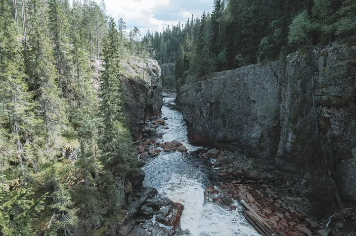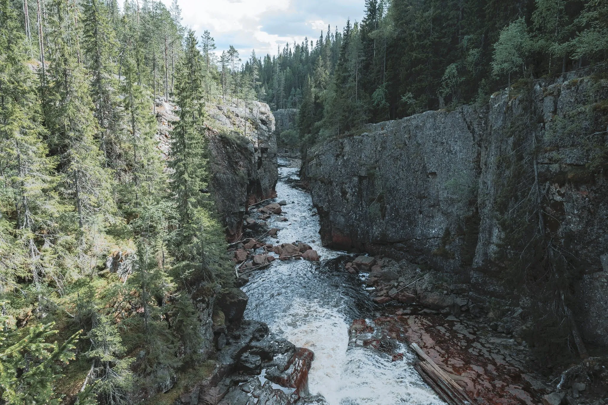
The Helvetesfallet lies in the forest north of Orsa in Dalarna. Here the river Ämån squeezes through a narrow, deep gorge. According to Länsstyrelsen Dalarna, the county administrative board, a meltwater river from the inland ice cut it into the rock, and the water foams 30 m below. According to Wikipedia the walls are around 30 m high. The gorge is a nature reserve of about 2 ha and a Natura 2000 site, managed by the municipality of Orsa. The path down from the car park is short. We were here on 5 June 2021, on the stage from Rätan to Orsa.
First we had hiked in Hamra National Park. We picked up our lunch at a very remote ICA in the middle of nowhere. Then it was onto a very long gravel road, 11 km, to the Helvetesfallet. According to Länsstyrelsen Dalarna you drive about 3 km north from Orsa on road 45 and then take road 296 towards Skattungbyn and Voxna. At Mässbacken, after about 4 km, you turn left towards Orsa Tallhed airfield, cross the airfield and follow the signs. After that it is about 10 km of gravel road to a car park with a turning area. According to OpenStreetMap it is free.
From the car park a path led down through the dense birch forests to a reddish-brown gorge. A powerful waterfall flows through it. Länsstyrelsen Dalarna calls the path no longer than a couple of hundred metres, but steep, with roots and stones. Visit Orsa gives about 200 m. According to Visit Orsa the municipality improved and secured the path in autumn 2022 and built a staircase, so after our visit. Today OpenStreetMap shows two wooden staircases with handrails, with 49 and 64 steps. Visit Dalarna mentions safety nets and writes that there are still stony and rooty sections. According to Resebloggaren stones and roots become slippery after rain.
A suspension bridge led to the other side of the gorge. Our post does not say whether we crossed it. The map and track go from the car park down the stairs to the west end of the bridge. In the track that is 0.25 km one way, 0.5 km there and back with about 25 metres of ascent. That is a little more than the 200 m from Visit Orsa, because the line follows every bend of the path.
The bridge is closed today. According to Mora Tidning of 6 October 2025 an inspection found rust on metal parts. The municipality of Orsa then closed it until further notice, and it is to be replaced. Upplevelsebloggen writes in September 2026 that it was still closed during their visit in the summer. They went down the stairs and looked into the waterfall from the side.
According to Länsstyrelsen Dalarna the Ämån used to be a timber-floating route. Remains of a skibord, logs laid parallel on the riverbed against log jams, can still be seen. The forest in the humid gorge on calcareous rock is old and barely touched, with lichens and mosses such as trådbrosklav and purpurmylia. According to Visit Orsa the Storstupet gorge lies 5 km further south, and according to the municipality of Orsa the Siljansleden trail passes both.
How long we spent down there, we did not record. Our post calls it a short visit. Afterwards we drove on to our Airbnb.