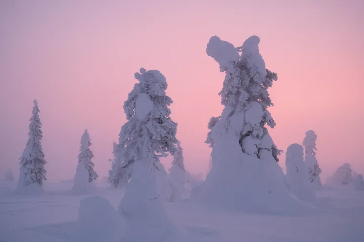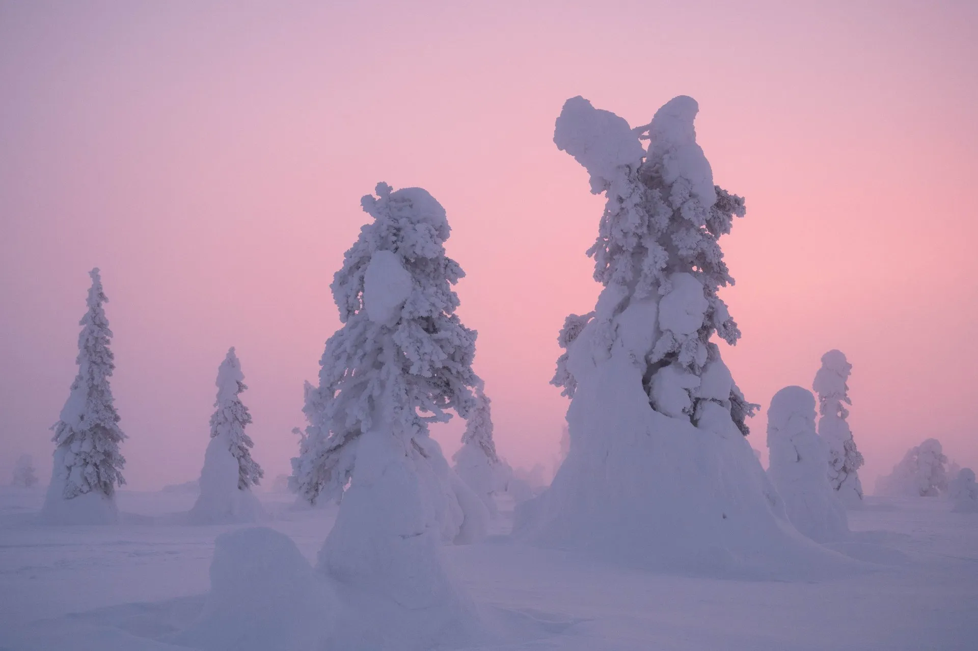
Riisitunturi is a 465 metre high fell in the national park of the same name near Posio in Lapland. In winter so much snow settles on its spruces that they stand in the landscape like figures. We were there on two afternoons in a row in February 2024, both times at around -25 °C. On the first day we turned back frozen through shortly before sunset, on the second we hurried up for dusk.
The waymarked path to the summit is the Riisin rääpäsy loop of Metsähallitus, which manages the national parks in Finland. According to Metsähallitus it is 4.5 km long, marked with green wooden posts and recommended clockwise. Other sources, including the park’s snowshoe page and our post, give 4.3 km. Metsähallitus grades the loop as medium and allows 2 to 3 hours, in our post we called it easy. Whether we walked the whole loop is something we did not record.
Getting there and parking
Both times we set off after lunch at our accommodation, and on the second day the drive home took 45 minutes. The access road turns off at the address Patoniementie 180 in Posio. From there a narrow, single-lane gravel road leads about 3 km to the car park. It is cleared in winter, but there was still snow on it when we drove it. Our car had spike tyres and gripped the ice with them. On the second day we came upon an accident on the way: Two cars had collided head-on on the snow-covered road. Fortunately nobody was seriously hurt, and after that we drove considerably more carefully.
The car park at the edge of the national park is large, with space for about 200 cars. Several routes start there, and both times we headed towards Riisitunturi. At the trailhead there is an information board about the national park and an accessible dry toilet. Since 1 September 2026 a paid parking trial has been running here until spring 2027. From 9 am to 6 pm parking costs 1 € per hour after the first 30 minutes, at most 5 € per day, plus a service fee. Payment is with the EasyPark app. During our visits in 2024 the trial did not yet exist.
Up Riisitunturi
From the trailhead it is 1.7 km to the summit according to Metsähallitus, on a fairly wide gravel path with some duckboards, roots and stones. It mostly climbs, but not too steeply, 105 metres over these 1.7 km. The elevation profile on our map is based on a coarse terrain model (EU-DEM) and shows the summit a good ten metres too low. In winter the loop is usually open, but it is not maintained. According to Metsähallitus it is well suited to snowshoes, but it is not marked as a snowshoe route as such. The path is usually trodden firm, but on the open slopes the wind can quickly drift it shut, and after heavy snowfall snowshoes are needed.
On the first afternoon the path first led us through forest. The snow was the finest powder we have ever seen, and it buried the trees completely. At just under -25 °C we felt the cold after a short while in our faces, hands and feet.
Further up the forest opens onto a plateau where the snow-covered trees stand alone and in groups. We took photos in every direction until the sun was low over the plain. Because we were properly frozen through, we turned back shortly before sunset.
On the second day it was cloudier and foggier. When we arrived at the car park at 3:40 pm, we could see barely anything of the setting sun. We started immediately and hurried all the way up, arriving out of breath. Up there the sun setting through the fog turned the sky and the snow pink. It was -25 °C again, and our eyelashes froze. For our hands and feet we had bought heat pads this time, which kept them nicely warm.
Ikkunalampi and back via the hut
According to Metsähallitus the summit looks east across Lake Kitkajärvi to the hills of Kuusamo and west across the national park. At the top the Rääpäsy and Rietas trails part. The Rääpäsy turns right and descends 600 m and 30 metres to the small lake Ikkunalampi, with a bench on the shore and duckboards by the water. After another 200 m it meets the Rietas again, and there it turns right for 200 m to the open Riisitunturi wilderness hut. There is a dry toilet, a woodshed and a fire pit. From the hut it is another 1.6 km, mostly downhill, back to the car park.
Which way we took down on our two afternoons is not in our posts. Both times we then drove straight back to our accommodation and warmed up in the sauna first.